Forging relationships with authenticity
Analyze. Assess. Advise.
Silver Fox Global Solutions
Five specialized divisions to support your decisions:
Geospatial Intelligence Strategy (GIS) Division
Purpose
To collect, integrate, and analyze geospatial information that provides organizations with an accurate understanding of their assets, infrastructure, and operating environment, enabling informed planning, efficient operations, and confident decision-making.
Mission
To deliver accurate, reliable, and actionable geospatial intelligence by integrating aerial imagery, remote sensing, GIS, photogrammetry, thermal technologies, and spatial analysis into comprehensive solutions that support engineering, infrastructure management, and operational excellence.
Key Outcomes
-
Transform Data into Intelligence
Convert aerial and spatial data into meaningful geospatial products that support informed operational and engineering decisions. -
Enhance Infrastructure Awareness
Provide accurate mapping, asset documentation, and condition assessments that improve visibility across facilities, construction projects, and critical infrastructure. -
Support Better Decision-Making
Deliver engineering-ready geospatial information that reduces uncertainty, improves planning, and strengthens long-term asset management.
Produces:
-
GIS products
-
Orthomosaics
-
LiDAR
-
Point clouds
-
Thermal maps
-
CAD files
-
Digital twins
-
Spatial datasets
Sky Fox Aerial Operations (SFAO) Division
Purpose
Safely deploy aerial assets to collect accurate imagery, thermal data, mapping products, and infrastructure intelligence.
Mission
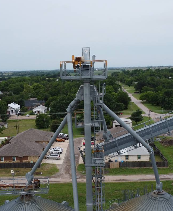
The Sky Fox Aerial Operations Division provides professional aerial intelligence services that help organizations safely inspect, monitor, and document assets from above. By combining precision drone operations with thermal imaging and advanced aerial data collection, we deliver accurate information that supports faster, safer, and more informed decisions.
Key Outcomes
-
Detect thermal failures before they become costly problems.
-
Reveal hidden conditions and operational blind spots.
-
Document infrastructure health with accurate aerial records.
Analysis & Intelligence (AI) Division
Purpose
Transform geospatial data, imagery, and documentation into meaningful intelligence that helps organizations understand conditions, identify trends, and make informed operational decisions.
Mission
To analyze, interpret, validate, and communicate geospatial information through comprehensive reporting, comparative analysis, and intelligence products that support strategic planning and operational effectiveness.
Key Outcomes
-
Transform complex data into actionable intelligence.
-
Deliver professional reports, comparative analyses, and executive briefings.
-
Support confident decision-making through objective analysis and documented findings.
Produces
-
Executive summaries
-
Findings
-
Recommendations
-
Comparative studies
-
Change detection
-
Infrastructure health reports
-
Asset condition reports
-
Client presentations
Disaster Response Division
Purpose
Provide rapid geospatial intelligence, aerial reconnaissance, and comprehensive documentation that helps organizations assess damage, prioritize response efforts, and support informed recovery following natural or man-made disasters.
Mission
To deliver timely, accurate, and actionable geospatial information that enhances situational awareness, supports emergency operations, and assists clients in protecting lives, infrastructure, and critical assets during response and recovery operations.
Key Outcomes
Rapid Situational Awareness
Provide timely aerial intelligence and geospatial assessments that help organizations quickly understand disaster impacts and establish operational priorities.
Accelerate Damage Assessment
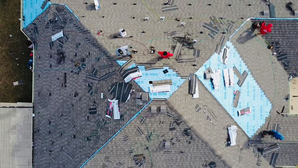
Deliver accurate mapping, infrastructure documentation, and visual records that support emergency response, recovery planning, insurance documentation, and resource allocation.
Primary Capabilities
-
Rapid Aerial Reconnaissance
-
Disaster Damage Assessments
-
Infrastructure Condition Assessments
-
Flood Mapping
-
Wildfire Documentation
-
Earthquake Damage Documentation
-
Storm Damage Assessments
-
Utility & Critical Infrastructure Assessments
-
Search Support (when requested by authorities)
-
Emergency Mapping
-
Thermal Aerial Assessments
-
GIS Disaster Products
-
Situation Reports (SITREPs)
-
Before & After Comparative Analysis
-
Recovery Progress Documentation
-
Executive Briefings
Visual Intelligence & Documentation (VIDO) Division
Purpose
Create accurate, comprehensive, and organized visual documentation that preserves the complete history of a project while supporting engineering, operational, legal, and business decision-making.
Mission
To provide professional visual documentation and organized project records that accurately capture site conditions, operational activities, and infrastructure throughout every phase of a project, creating reliable historical records that support accountability, transparency, and informed decision-making.
Key Outcomes
Preserve Project History
Develop comprehensive visual records that document infrastructure, facilities, assets, and project progress from beginning to completion.
Support Accountability
Produce organized documentation that validates completed work, supports project reporting, and provides objective visual evidence for future reference.
Strengthen Communication
Deliver professional photography, videography, and visual reporting that improves collaboration among clients, stakeholders, engineers, and project teams while providing approved media suitable for presentations, reports, and marketing.
Primary Responsibilities
-
Site Photography
-
Infrastructure Photography
-
Facility Documentation
-
Drone Photography
-
Progress Photography
-
Before & After Documentation
-
Time-Lapse Documentation
-
Executive Photography
-
Technical Photography
-
Video Documentation
-
Historical Archives
-
Project Media Libraries
-
QA/QC Visual Records
-
Client Deliverables
-
Marketing-Approved Imagery
SFGS Projects
Case Study: Data Center
SFGS’s Integrates Aerial Intelligence Division by leveraging advanced aerial mapping, thermal detection, and operational intelligence technologies to support large-scale enterprise and critical infrastructure operations.
Our scalable and customizable capabilities support every phase of infrastructure development — from strategic site acquisition and environmental assessment to implementation, operational monitoring, and long-term resilience planning.
By delivering persistent visibility and actionable intelligence, SFGS helps clients build safer, smarter, and more adaptive operations designed to evolve with emerging operational, environmental, and security challenges.
Shoreline | Erosion Assessment
Climate change is accelerating shoreline erosion, destabilizing waterfront properties, and increasing environmental risk across the country.
This presentation highlights how Silver Fox Global Solutions and its Sky Fox Integrated Aerial Intelligence Division deliver critical aerial intelligence, environmental monitoring, and operational visibility to help clients identify vulnerabilities early, protect valuable assets, and strengthen long-term resilience before small changes become costly losses.
Post-Storm River Assessment
Post-storm events and climate change are rapidly altering river systems, increasing erosion, destabilizing infrastructure, and creating greater environmental risk for communities and critical assets.
This presentation highlights how Silver Fox Global Solutions and its Sky Fox Integrated Aerial Intelligence Division deliver critical aerial intelligence, environmental monitoring, and operational visibility to help clients assess damage, identify vulnerabilities early, support informed decision-making, and strengthen long-term resilience before evolving conditions become costly disasters.
Inquire About Our Geospatial Services
Contact our strategic intelligence team to evaluate your infrastructure risk profile. We provide executive-level reporting on aerial intelligence and operational continuity protocols on a global scale.
Operational Headquarters
Central Texas Intelligence Hub
Austin, Texas, USA